
Southeast of Grand Canyon National Park and north of Flagstaff, Arizona lies a sweep of several miles of land that's festooned with volcanoes and the remnants of volcanic eruptions. This region is called the San Francisco Volcanic Field. It includes several hundred volcanic features, including volcanoes large and small, lava flows, lava domes, and more. The centerpiece of the San Francisco Volcanic Field is the tight cluster of mountains called the San Francisco Range or San Francisco Peaks.
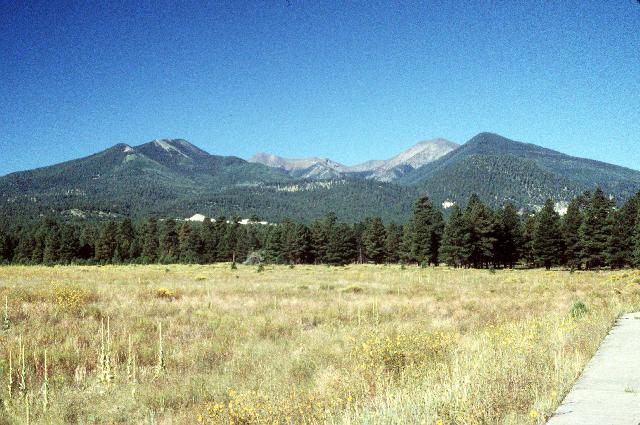
San Francisco Peaks as seen from the east. This view looks directly into the crater's open side.
These six spires are the remnants of a huge volcano that blew its guts out in a lateral-blast explosion similar to the big Mount St. Helens eruption of May 1980. All six are more than 11,000 feet high. The center-right spire, with the white cap, is called Humphreys Peak. Its summit is the highest point in Arizona, 12,633 feet above sea level. The Colorado Plateau at this point is about 7,300 feet above sea level, so Humphreys Peak is about a mile above the surrounding land. The best estimate says that the original peak of the volcano was about 16,000 feet above sea level, nearly a mile higher than Humphreys Peak.
If you turn in the other direction, you can see Sunset Crater itself. Sunset Crater is a classic example of a cinder cone about a thousand feet high, with the steep sides typical of a cinder cone. At around a thousand years old, it's the youngest volcano in the area. The volcanoes of the San Francisco Volcanic Field show a distinct pattern of formation which indicates there's a weak hot spot deep underground here, which breaks through every now and then to form another volcano. Sunset Crater itself is probably extinct, but there's a definite possibility of further volcanic activity here.
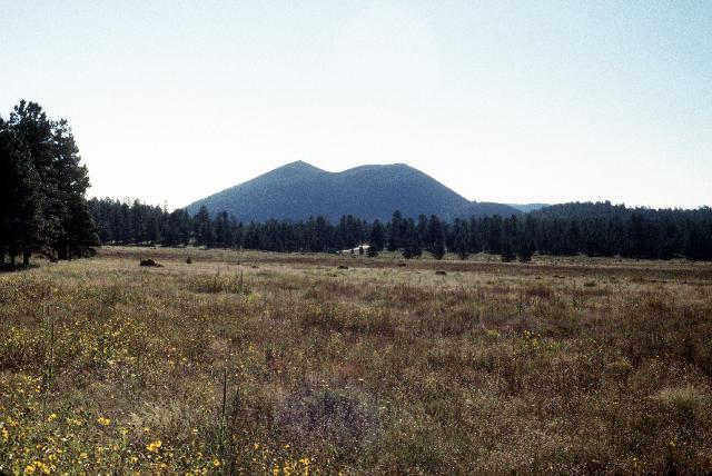
Sunset Crater seen from the same place as the above view of San Francisco Peaks. This view shows its western side.
There are several overlooks and observation points in Sunset Crater Monument. From one, you can look over the main part of the Bonito Lava Flow, a flow of thick, doughy lava that originated from Sunset Crater and covered several hundred acres. Parts of Bonito Flow are still bare rock today, a thousand years later. Another overlook is at the top of Lennox Crater, a short cinder cone only 250 feet high (but very steep). Finally, a road winds north from Sunset Crater toward Wupatki National Monument; along this road, the Cinder Hills Overlook gives a look at the northeast side of Sunset Crater, including the red-rock rim that gave it its name.
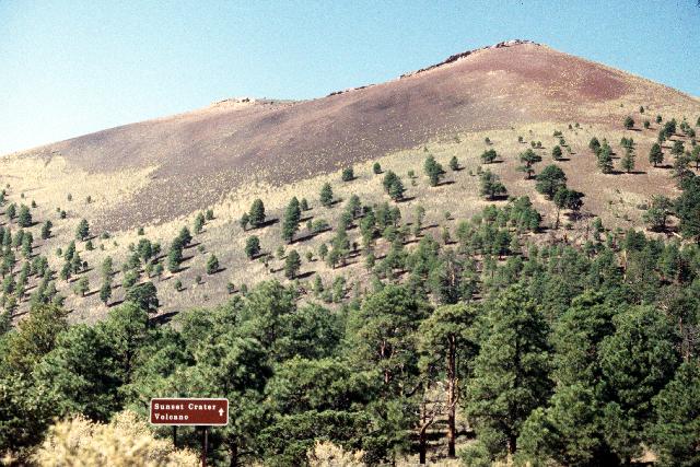
Sunset Crater's northeastern side. A thousand years old, and the upper part of the cone is still bare rock.
North of Sunset Crater, the road leads to Wupatki National Monument, a spread of several hundred acres that includes several important archaeological sites. The major one is Wupatki Ruin itself, the remains of a small Sinagua Amerind village that dates from almost the same period as Sunset Crater. The main structure at Wupatki is an impressive piece of work, for all its age and partially ruined condition:
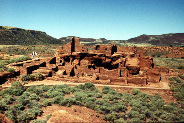
This freestanding stone structure is built of blocks and bricks quarried from the surrounding bedrock, which is primarily a series of red-orange rock layers called the Moenkopi Formation. The pueblo was at least three stories high and may have contained thirty or more rooms. The Sinagua who built Wupatki and other pueblos in the area had no technology more advanced than hand tools -- no beasts of burden, no wagons or carts, nothing. Yet they built so well that this pueblo remains largely intact and recognizable close to eight hundred years after it was abandoned.
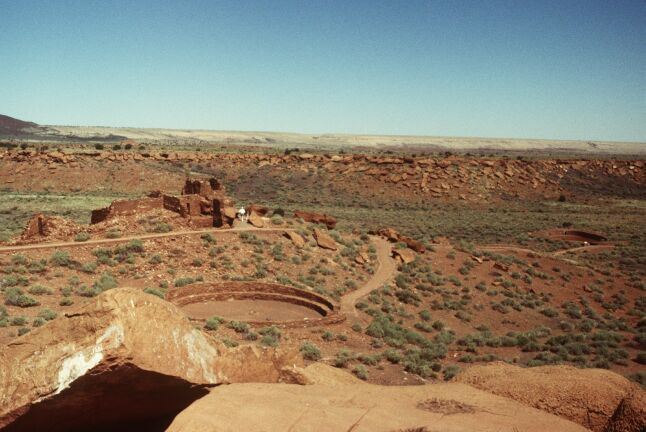
This is the lower area of Wupatki Ruin, downhill and to the right of the main building. At left-center is a smaller pueblo, with only a few rooms. In the foreground is a circular kiva, or community meeting place, where all the adults could gather for ceremonies and meetings. In the distance at the right is another circular structure, a gaming court or ballcourt where kids played several types of games. (I didn't know this, but gaming and gambling were very popular among the pueblo Amerinds.) All round these structures were small gardens, wherever there was fertile ground (the Colorado Plateau is very dry, on the edge of being a desert). This pueblo may have supported fifty or sixty people, but probably not many more. Still, it was remarkably well constructed, and shows that humans can build some pretty nice places even without advanced technology.
As I left Sunset Crater Park, I stopped for a moment to take another picture of the San Francisco Peaks, this time looking almost directly south at them.
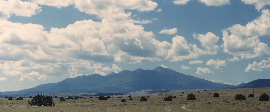
This photo does a wonderful job of showing the "beheaded cone" arrangement of the Peaks. Humphreys Peak is on the far right. Seen this way, there's no doubt they were once a single great mountain.