The East Rim Drive extends 26 miles from Grand Canyon Village to Desert View, with overlooks scattered all along its length. It's open to cars and there's no shuttle bus. I drove directly out to Desert View, then stopped at a number of overlooks on the way back. Almost right away I got a graphic demonstration of why the West Rim is closed to cars: Desert View's parking lot has well over a hundred parking spaces, and I had to hunt to find an empty one. When I left about an hour later, there were a number of cars prowling the parking lot and waiting for spaces to open up.
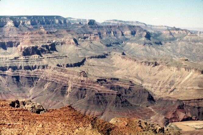
Like Yavapai Point, Desert View is one of the major observation points for the whole South Rim. Desert View has a large observation deck that provides a sweeping view of the entire eastern end of the Park. Not the eastern end of the canyon -- that's another forty or fifty miles upstream. The view from Desert View is stunning, from a flat-topped mesa called Cedar Mountain to the east, around to the main part of the Canyon stretching away to the west.
Almost right in front of the observation deck is a sweeping bend in the Colorado River. I shifted back into rockhound mode when I looked at this, because it offers a perfect view of the set of rocks called the Grand Canyon Supergroup, a half-dozen rock layers that occur between the Vishnu Schist and the upper layers of the Canyon. The Grand Canyon Supergroup almost exactly splits the difference in age between the Vishnu Schist and the Tapeats Sandstone: the Vishnu is 1,700 million years old, the Tapeats Sandstone is 530 million years old, and the Grand Canyon Supergroup rocks range between 870 and 1,200 million years old. As with the Great Unconformity, I've read about this, but to actually see it was mind-boggling.
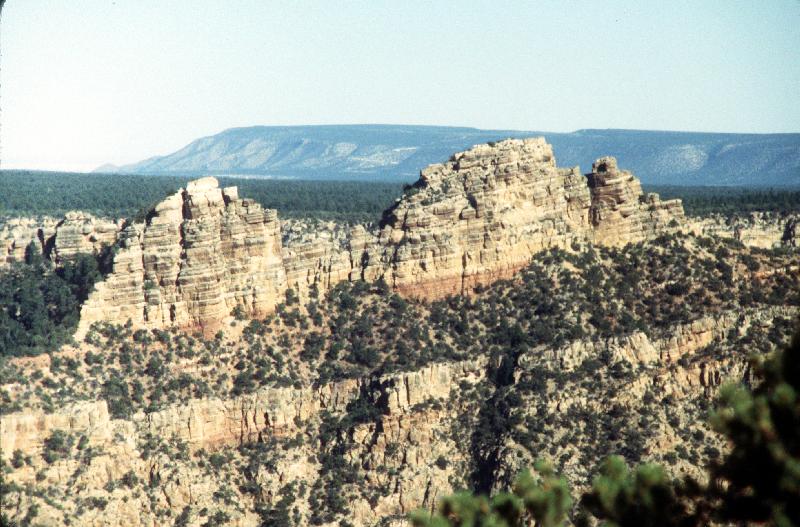
From Desert View I headed back along the East Rim Drive toward Grand Canyon VIllage, stopping at a number of the overlooks. At one of the overlooks my eye was caught by this rock formation nearby on the South Rim. It looked so much like a sinking ship that I mentally tagged it the Sinking Ship Formation and snapped a few pictures of it. Later, I discovered that it apparently looks the same way to others-- even the National Geographic Park Profile of Grand Canyon calls this the Sinking Ship Rock.
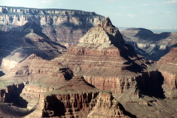
After my day-trips to Petrified Forest and Sunset Crater, I returned to Grand Canyon on the last day of my trip, to see a sunset over the Canyon. The angled late afternoon sun brings out a rather different side of the Canyon, especially with the clouds floating by. I got several very good pictures that afternoon. This is a wide-angle vista taken from Grandview Point about an hour before sunset:
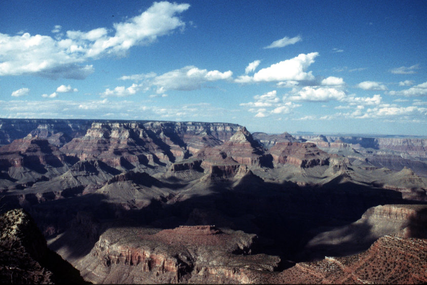
Just right of center in the above photo is a massive butte with one of the temples atop it. I thought this one was called the Cheops Pyramid, but some research finally convinced me that this is instead an end-on view of the huge butte called the Vishnu Temple. Here's a closer view of it, taken a few minutes later:
(These are only a scant few of the photos that came out good, let alone the ones I took. More will be coming when I can get them scanned.)
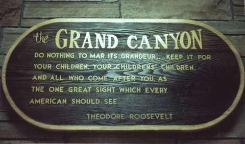
Also on the last day, I went back to the Grand Canyon Visitor Center and took a picture of a sign there. It seemed a perfect last memory to take away with me...